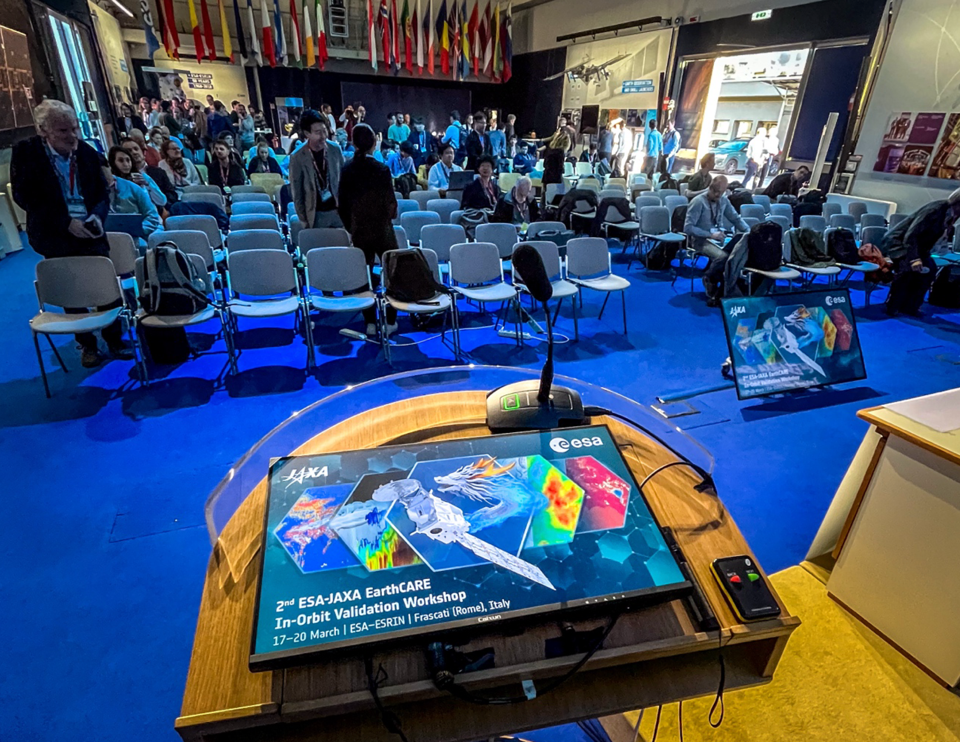
EarthCARE’s data products are now fully available, offering users more precise and detailed atmospheric profiling data. An international team consisting of enthusiastic members from Europe, Japan, the USA, and other areas in the world came together in Frascati, Italy, to discuss the performance of the satellite data.
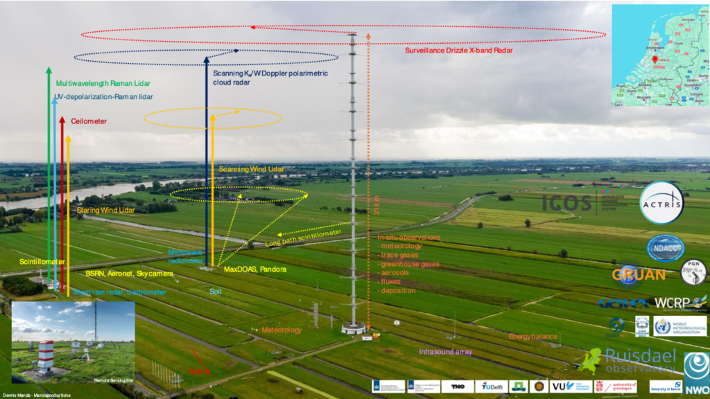
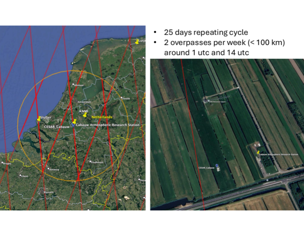
Using data from ground based instruments as well as airborne campaigns, the cloud and aerosol profiles from EarthCARE were closely studied. The Ruisdael Observatory station in Cabauw also contributes with its full suite of instrumentation (Fig. 2), that is situated at a location very close to the ground track of the satellite (Fig. 3).
Figure 2: Overview of the Cabauw Atmospheric Research Station
Figure 3: The EarthCARE 25 day groundtrack repeat cycle (left) and a zoom in at the close overpass over the Cabauw station with cloud radar and lidars indicated (right).
EarthCARE Launched on 28 May 2024, ESA’s Earth Cloud, Aerosol, and Radiation Explorer (EarthCARE) mission is the largest and most complex Earth Explorer to date. With its four instruments — a Cloud Profiling Radar (CPR), an Atmospheric UV Lidar (ATLID), a Broadband Radiometer (BBR), and a Multispectral Imager (MSI) — EarthCARE makes a variety of measurements that, when working together, provide unique insights into the complex interactions between clouds, aerosols and radiation.
Most satellite missions can only capture horizontal images, essentially observing clouds from above, like a camera in space. EarthCARE, however, is unique in its ability to profile clouds and aerosols horizontally and vertically. It provides an additional side view and thus delivers precise measurements of clouds’ height and structure. This allows researchers to classify targets such as liquid and ice clouds, smoke and dust storms, while also determining their 3D structure. This capability is critical for understanding the role of clouds in the climate system, as well as the air-quality implications of events like wildfires and dust storms.
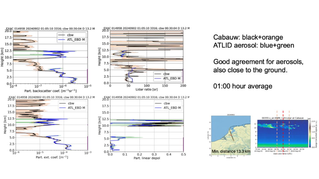
Figure 4: An example of a comparison between EarthCARE and Cabauw lidar aerosol profiles on 2 September 2024.
A closer look at the atmosphere The unique configuration of instruments on board of the EarthCARE satellite enable two types of data products: so-called Level-2a single-sensor products derived from individual instruments on EarthCARE, and Level-2b combined products derived from two EarthCARE instruments. By using the synergy between instruments like radar and lidar, the Level-2b products offer greater accuracy and detail than single-instrument outputs.
With the climate crisis accelerating and extreme weather events becoming more frequent, improving weather forecasts and climate projections is more urgent than ever. EarthCARE helps to tackle key uncertainties in climate modelling, such as how clouds will evolve in a warming world and the climate effects of aerosols. Together with our partners at JAXA, we are pleased to release these products and look forward to the new scientific insights they will unlock.